Posted: 07:27 AM ET
At this point, Mid Westerners would gladly sit through a triple showing of "The Smurfs" just to spend more time in the icy-cold movie theater air conditioning. I don’t blame them, either.
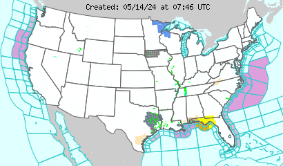
Here’s the deal with the heat: It is sliding east, so some Western states are seeing the warnings expire, but some Eastern states are seeing the warnings and watches appear for them. Counties from New England down to the Carolinas have been added to the heat watches for Thursday and Friday. I’ll have that on the show, but for now, you can check for your region on the map:
The huge high-pressure ridge and the strong July sun have combined over the last few weeks to create oppressive heat, and that ridge is on the move eastward as it gets pushed along by some storms in the North. I’ll show you all the spots that will see the heat break, plus where the heat will build, on the show.
Storms have been shooting up across the upper MW and SE this morning, so I’ll also have the active radar shots.
More monsoon moisture is in place across the Four Corners, so scattered storms will arrive there later today. The Rockies will get a taste of the action, too, as storms pop up in that area. Denver will see heat, as well.
The West Coast looks a little breezy, but dry until you get to NW WA.
*Follow "Morning Express with Robin Meade" meteorologist Bob Van Dillen on Twitter: @BobVanDillen

No comments:
Post a Comment